Impromptu Trip To Mt. Charleston
36.255424, -115.650185
It was a nice day, snow barely visible on the peaks of Mt. Charleston, so I planned an impromptu trip from Aliante to Cathedral Rock to show Panda the snow. He loves hiking even more than I do and out on our morning walk, I could tell the last thing he wanted to do is spend another day sitting on the couch watching me work on my laptop.
It was 10am and already getting approaching 80º in the valley. I packed a bag with food and liquids and we hit the road.
Mt. Charleston
The drive to Mt. Charleston is an amazing. You start at the desert valley floor just outside of Las Vegas, and travel up into the mountains on a surprisingly straight road. The landscape transforms from desert brush, to Joshua tree, to Juniper, to Pine. I was dressed in shorts and a t-shirt. On the way up, I realized that I might be under dressed for the hike. The temperature dropped approximately 5º every 1000′ of elevation gain.
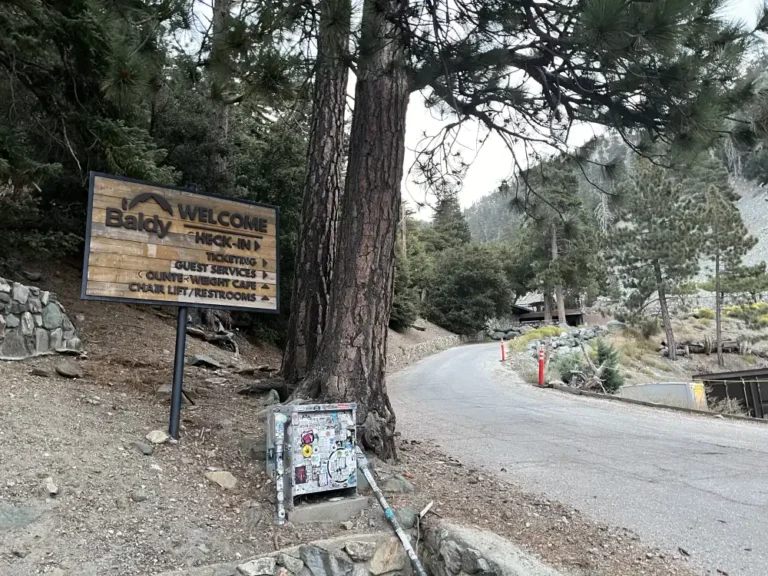
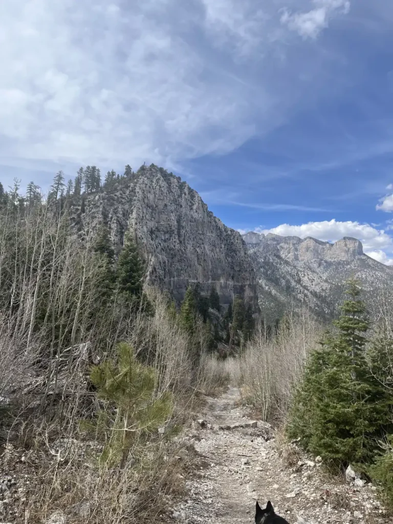
Panda and I went up to the top of Kyle Canyon, planning on hiking the few trails from Echo up to Little Falls and back and around to the top of Cathedral Rock.
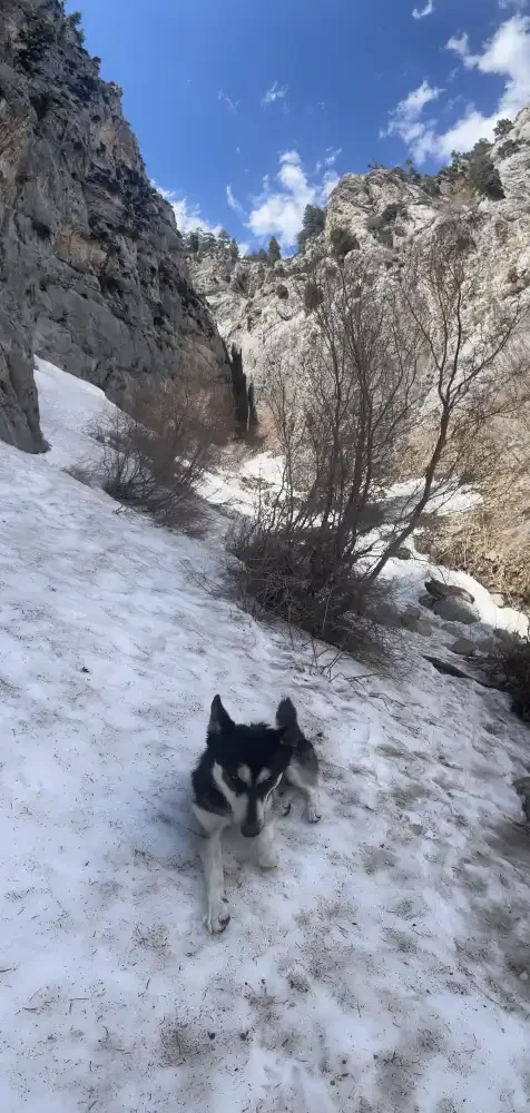
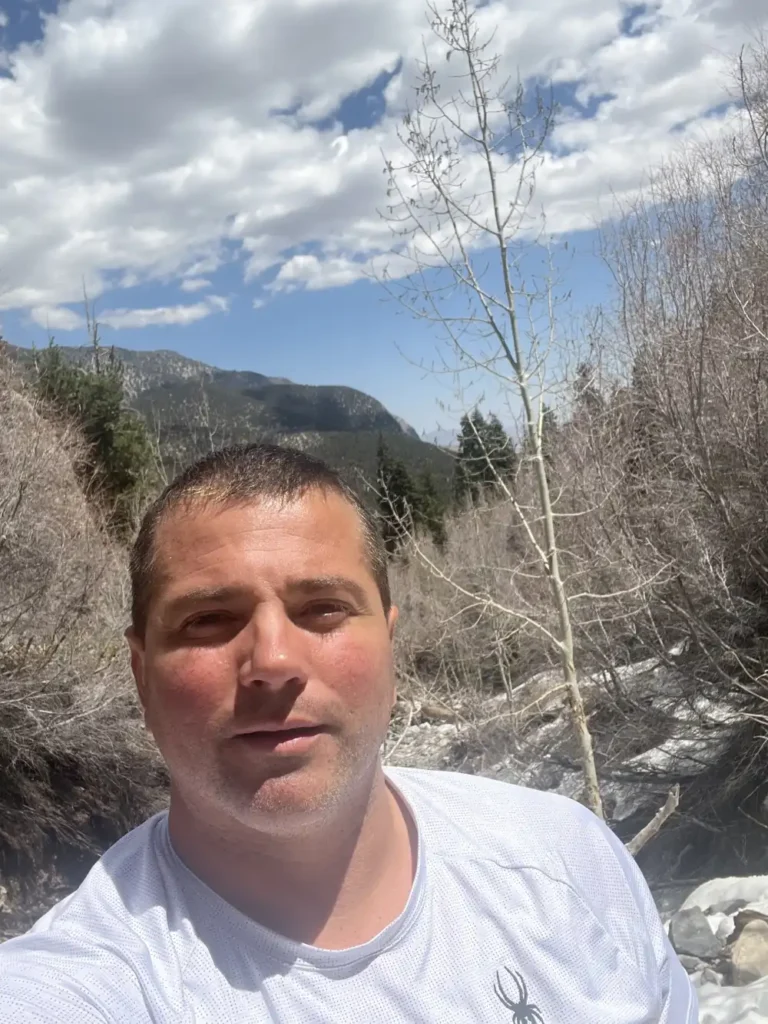
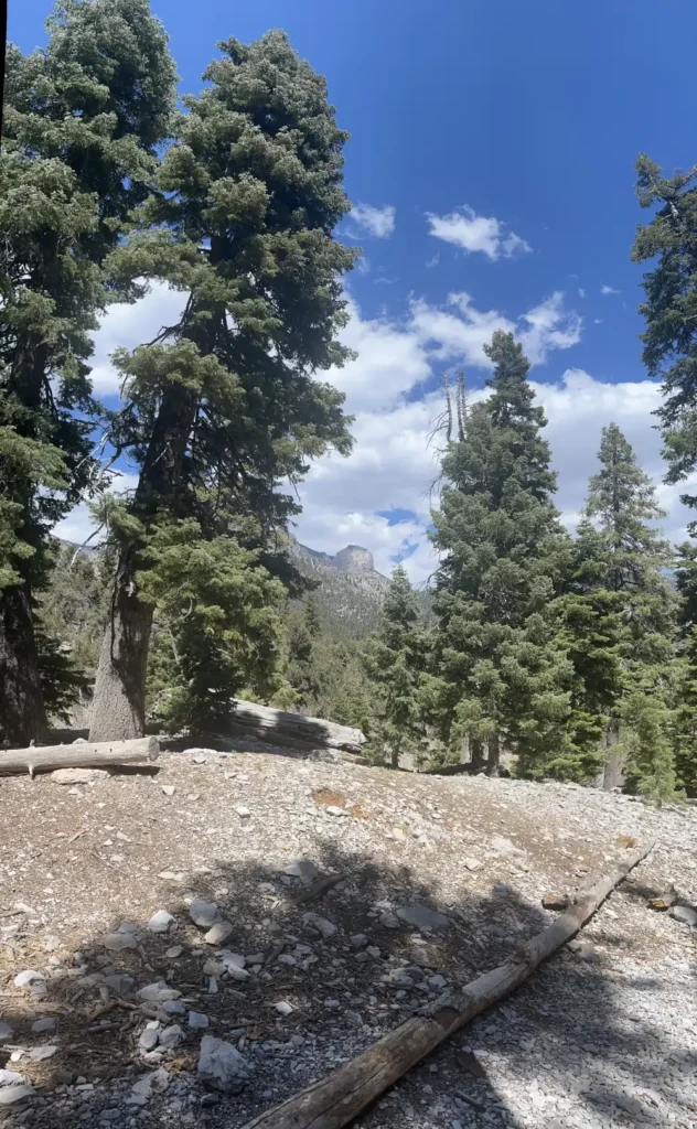
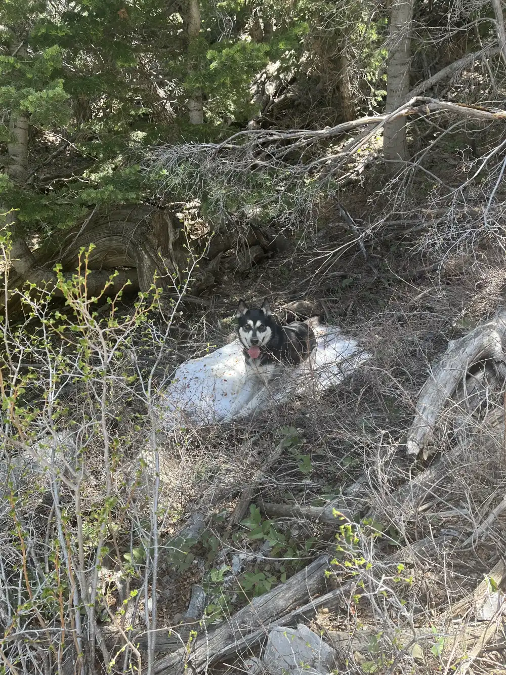
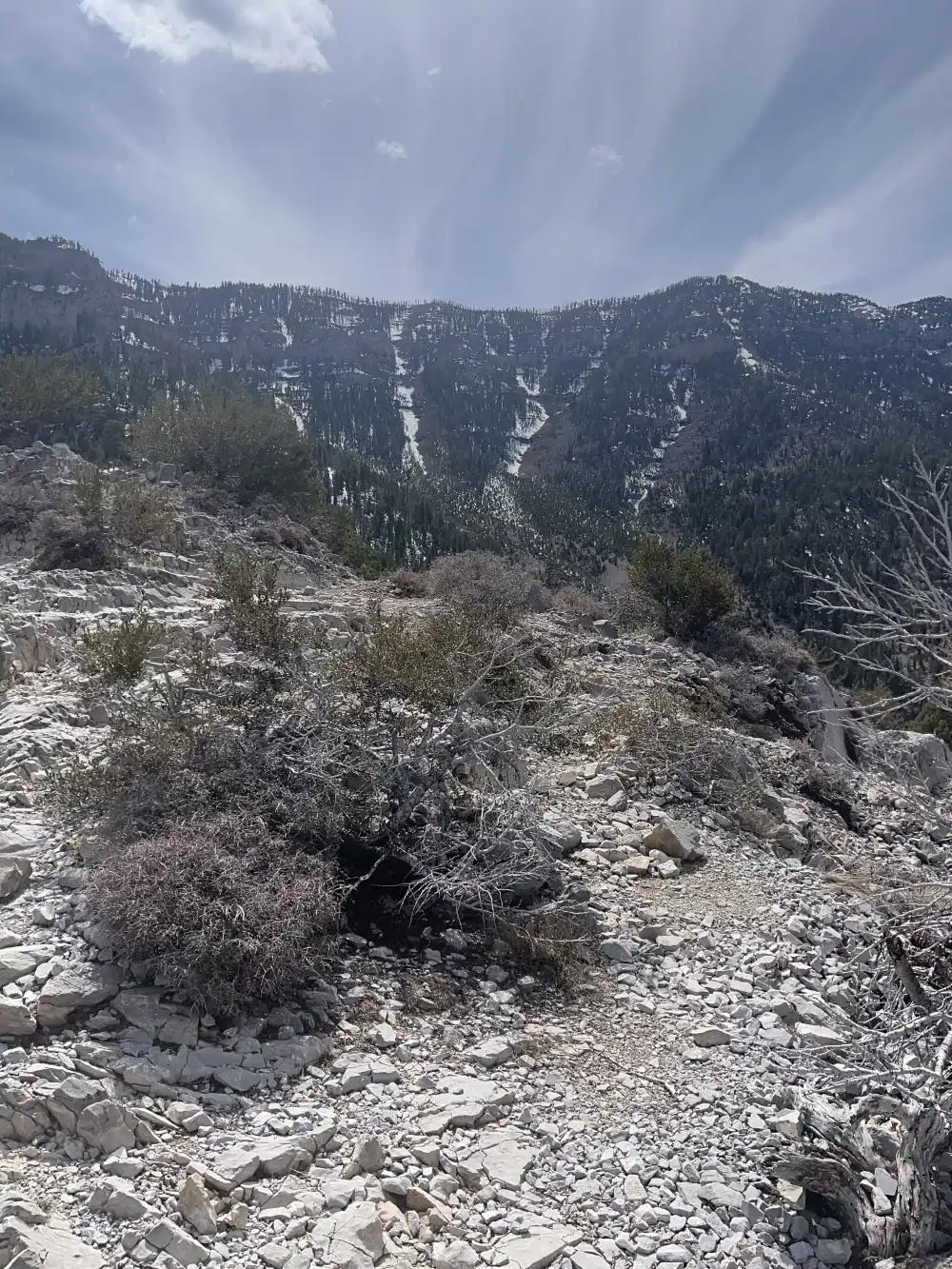
Little Falls – Panda’s First Snow
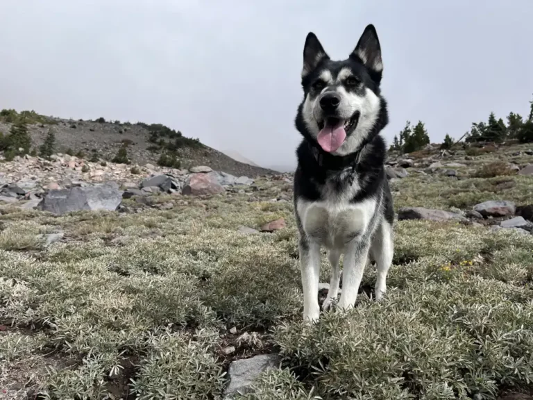
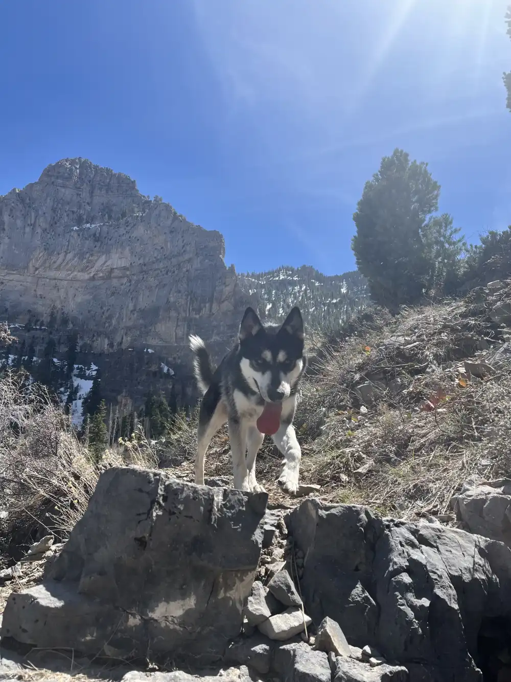
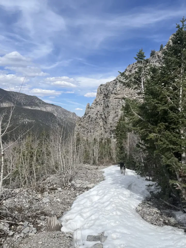
Little Falls in April feels like a hidden pocket of quiet tucked deep in the canyon. The air is crisp, still holding winter’s chill, and patches of snow linger along the shaded trail. Hiking back with Panda, the sound of crunching snow mixes with the faint trickle of melting ice — the namesake waterfall living up to its humble reputation. It’s less of a dramatic cascade and more of a gentle whisper of water over rock, but surrounded by steep canyon walls and tall pines, it feels peaceful and secluded. Panda bounds through the snow with easy energy, her black-and-white coat blending with the stark landscape, pausing just long enough to glance back before darting ahead up the narrow, snow-lined path.
Lunch At Little Falls
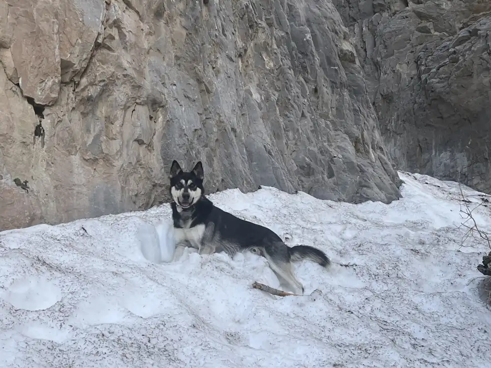
We stopped to eat lunch and admire the surroundings. I actually had cell reception! There was a slight view to the North, so we sat by the snow covered creek and had some snacks. Looking up at the cliffs, I had the urge to go climbing. At least hiking on something a little more dangerous than flat ground.
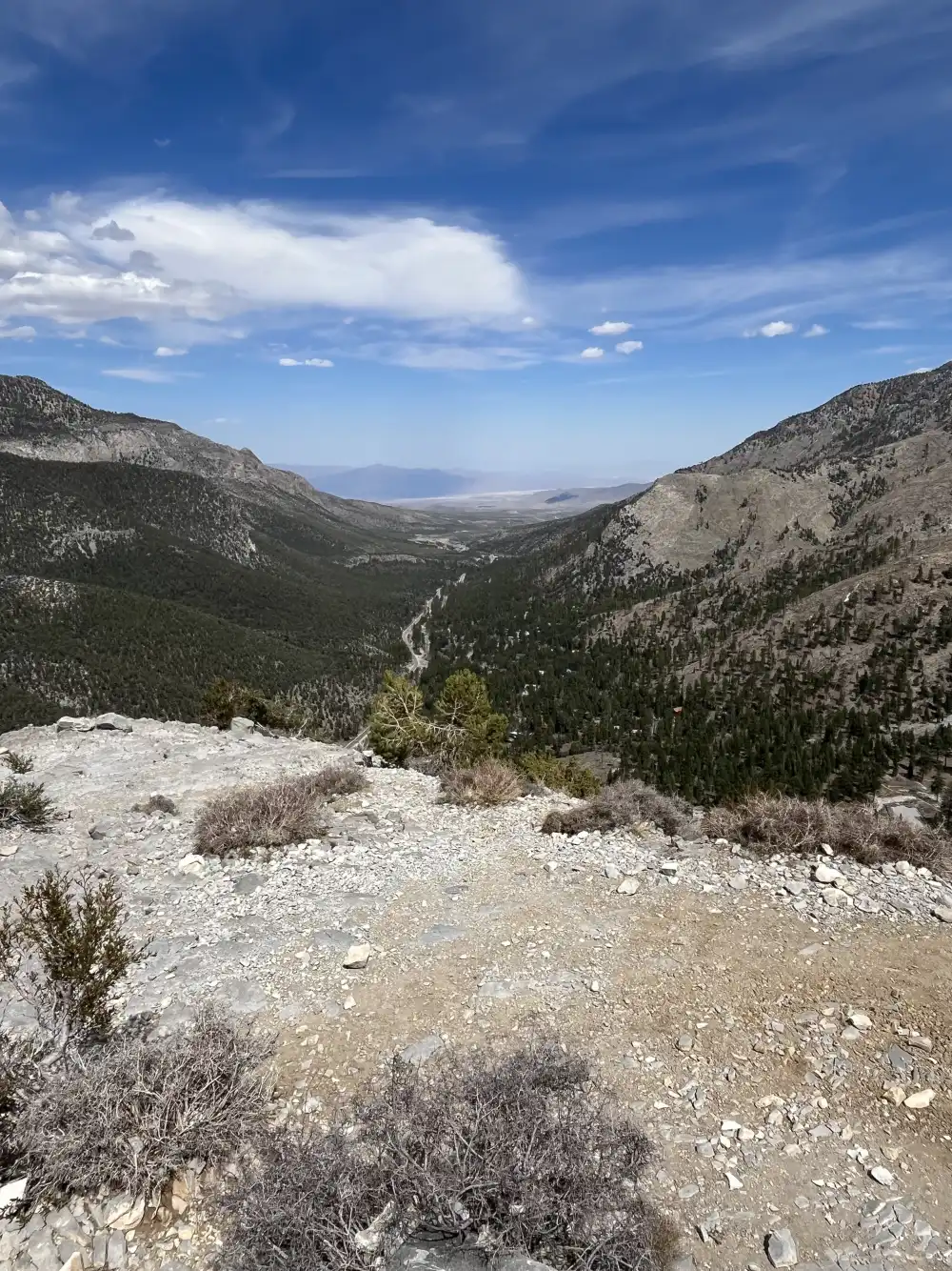
Midway BACK From Little Falls
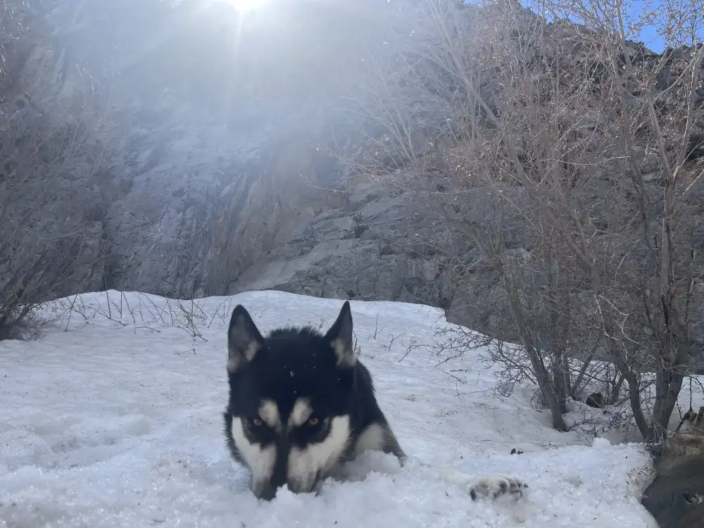
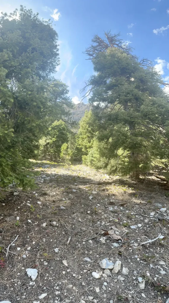
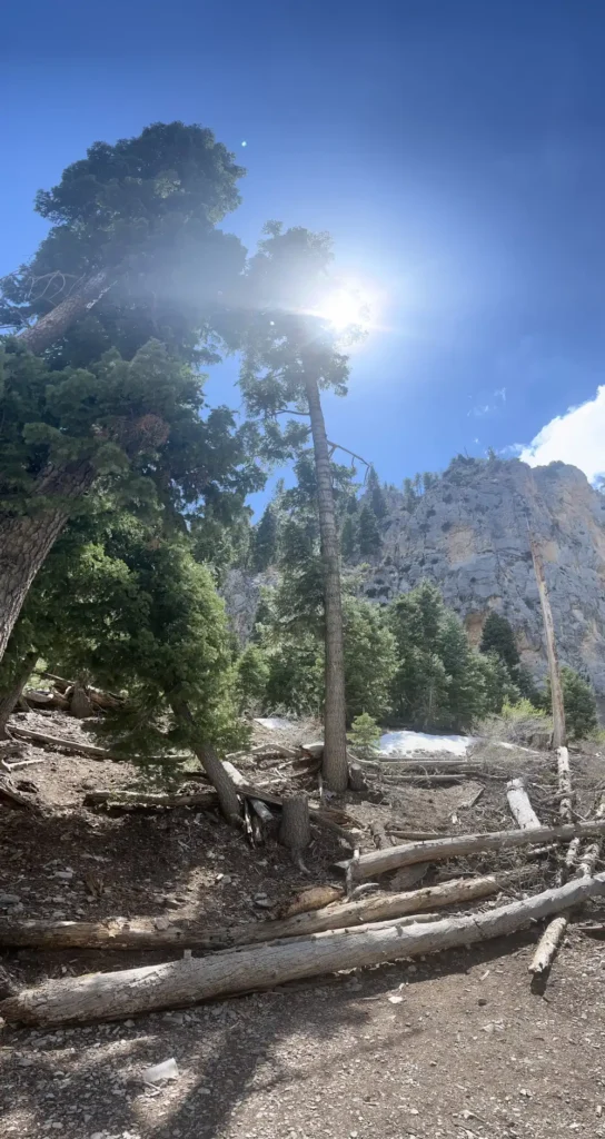
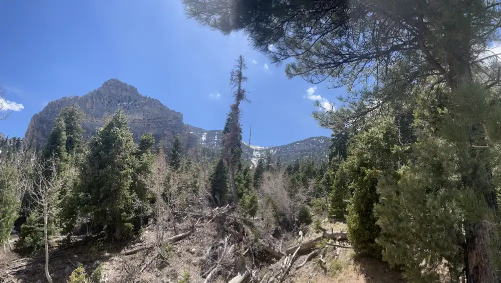
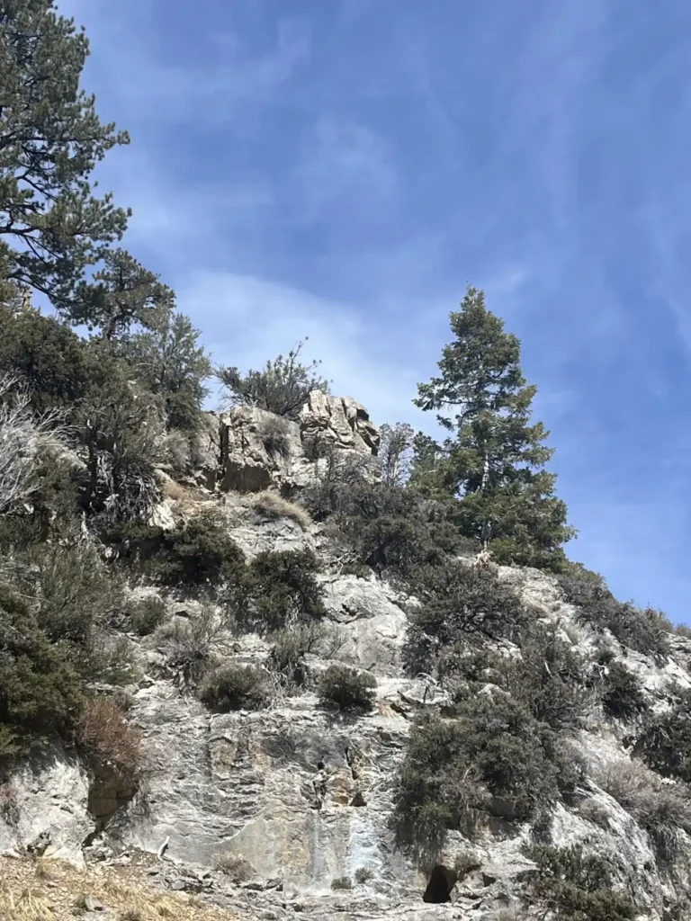
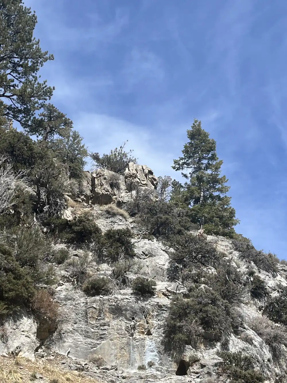
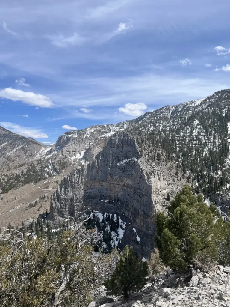
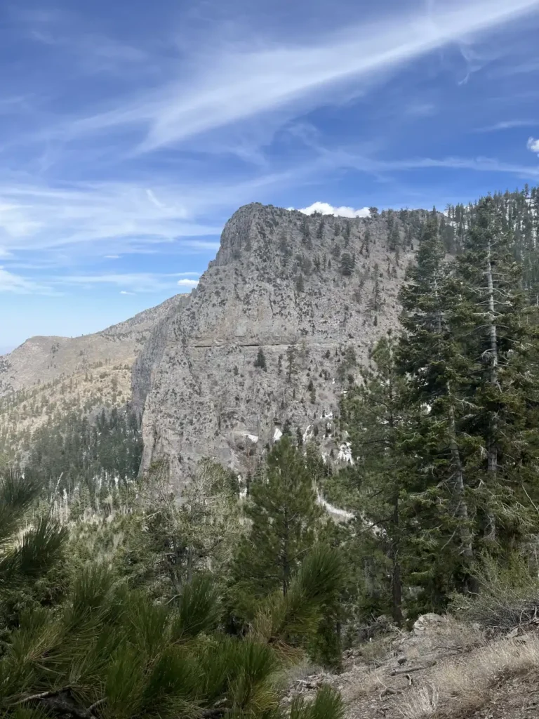
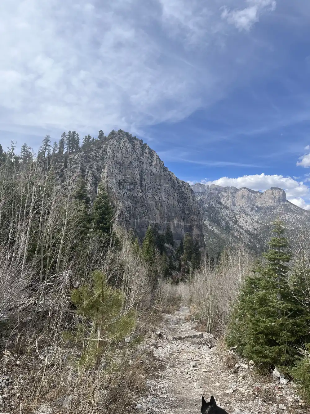
On the way back from Little Falls, the trail opens into a breathtaking sweep of alpine forest and rugged cliffs. The snow begins to thin, revealing rocky ground scattered with pine needles and sun-bleached logs. Tall evergreens frame the jagged face of the mountain ahead, their branches whispering in the cool breeze. Patches of sunlight spill through the canopy, catching on bits of melting snow and the pale limestone walls above.
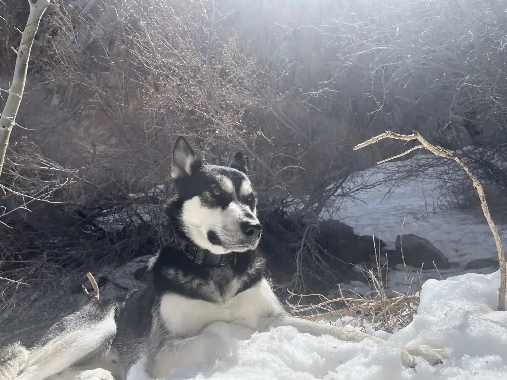
The air feels lighter here — crisp, dry, and full of pine — with the kind of silence that only deep mountain canyons hold. You can still hear the faint trickle from the falls far behind, but now it’s replaced by the crunch of gravel underfoot and the occasional gust shaking loose a dusting of snow from the higher branches. Panda trots easily along the path, stopping every so often to sniff the ground or glance up toward the cliffs, as if taking in the same vast, quiet beauty stretched out before you.
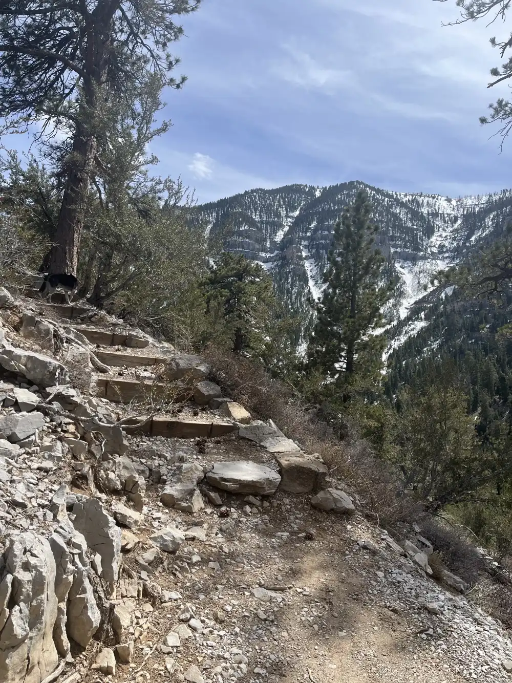
Cathedral Rock Trail
Heading back to the Jeep, I noticed the trail split off to the right. I wasn’t ready to leave yet, so I decided to see how far back it went. This was my first time on these trails and all I had was some map from a website that looked like a kindergartner drew it. I was on Echo Trail.
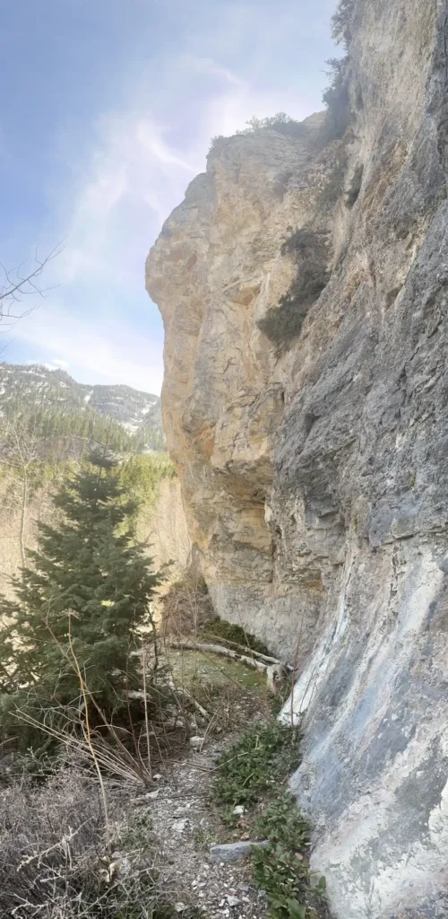
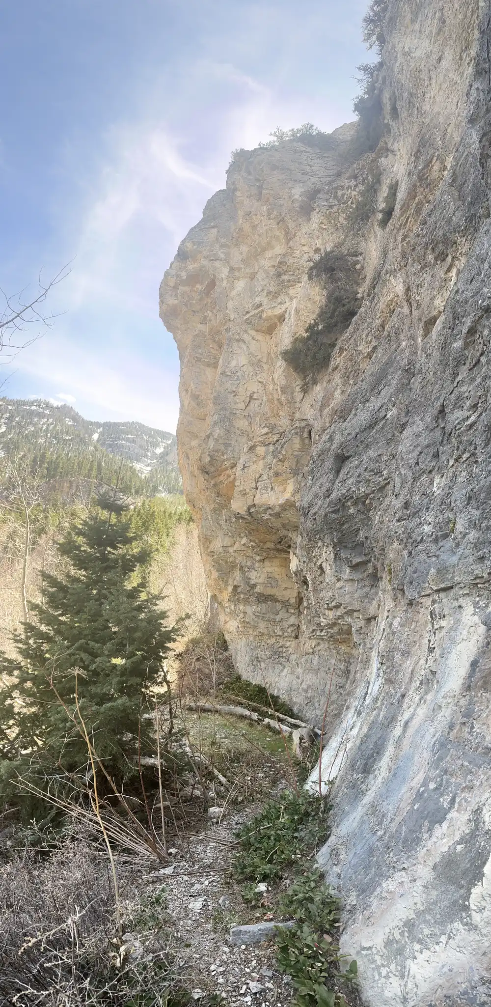
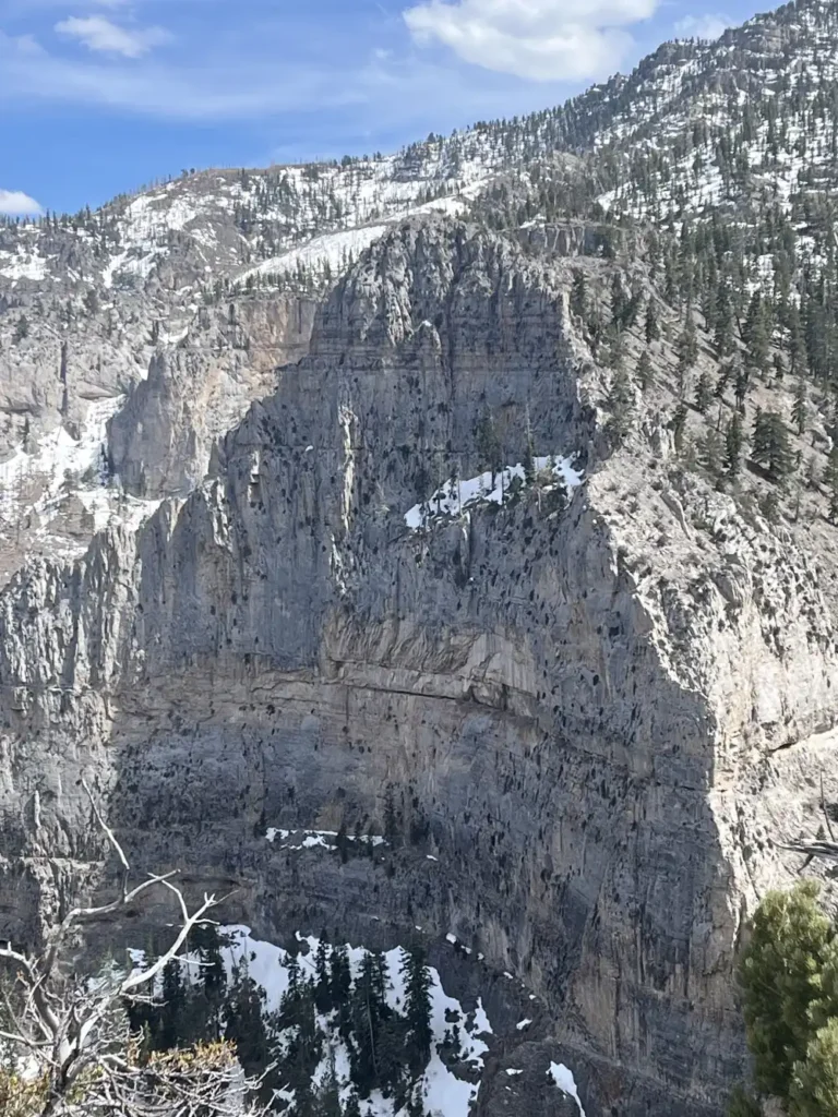
As I made my way around the north face of Cathedral Falls, I noticed the trail going away from the mountain. I thought that maybe I missed the turn, so I doubled back. I found a trail, but it looked more like a game trail. In my ignorance, I decided to see if this was the Cathedral Rock Trail–in my defense–the website said it was a hard climb.
As I climbed the mountain trail, it was clear that this was the path less taken. What makes you appreciate it even more than nature is that there are no tied up bags of dog poop off to the side, or paper wipes from what I am assuming are females squatting then littering (I’m sorry, but I’m starting to see that everywhere. Just take the 2 minutes to bury it!!!).
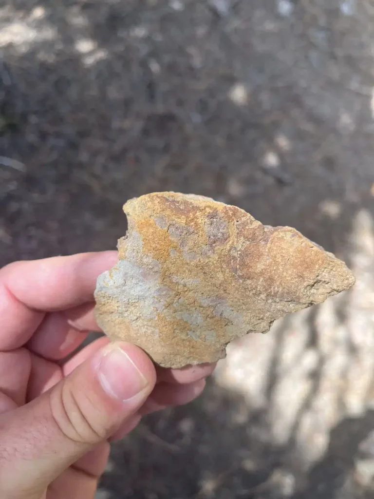
I didn’t take many pictures because the whole experience was so captivating. Snow patches, pine cones covering the path, little human presence, uprooted pine trees that fell in storms passed. I saw a lean-to, leaf shelter, and a round lodge hut along the way–probably made by a survivalist or some kids over night camping in the forest.
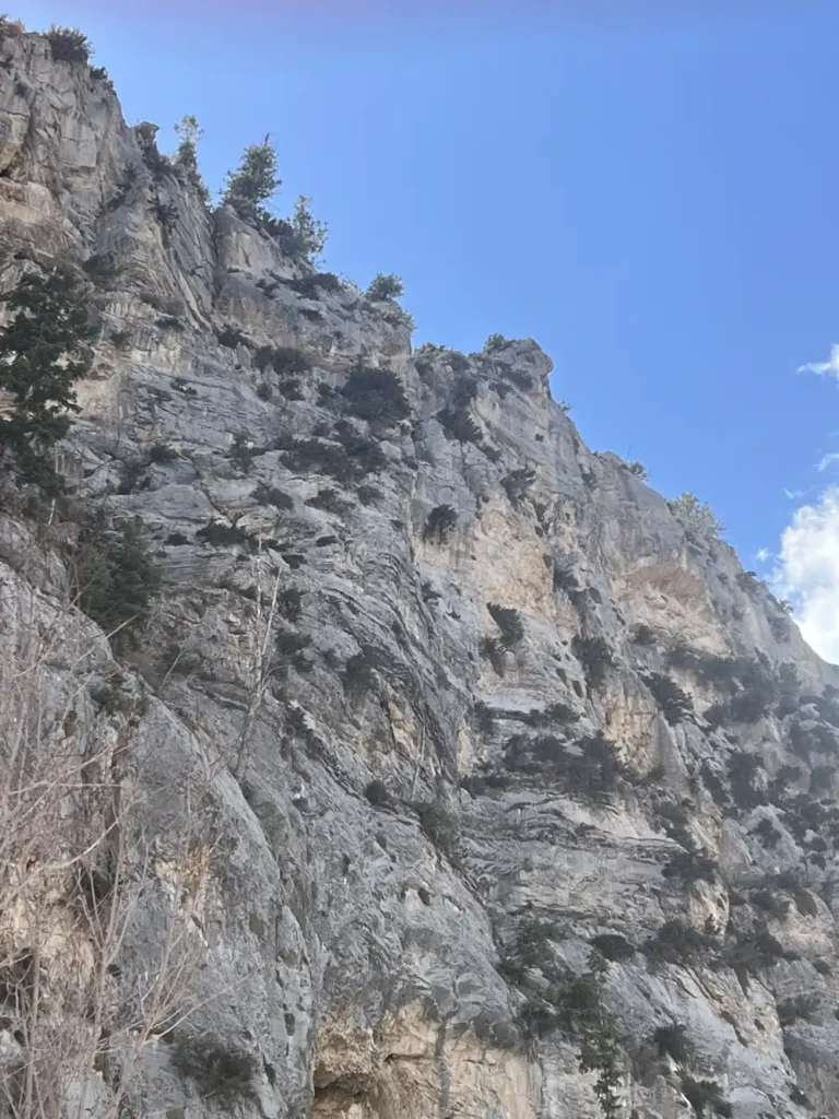
I also came across two awesome lead climbing routes. It made me wish that I could climb it. Still haven’t figured out how to lead climb solo… Both routes looked like they were at least 5.11+ and the quickdraws looked old and weathered. I’ve never been leading climbing outdoors anyways, so just looking at the anchors makes me think of every scary climbing movie I’ve ever seen where the anchor fails and the climber plummets to disaster.


Top Of Cathedral Rock
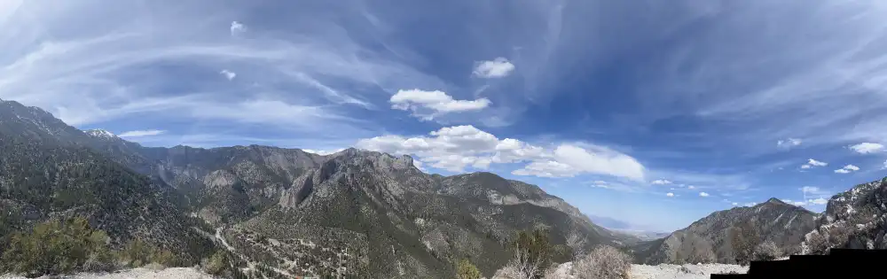
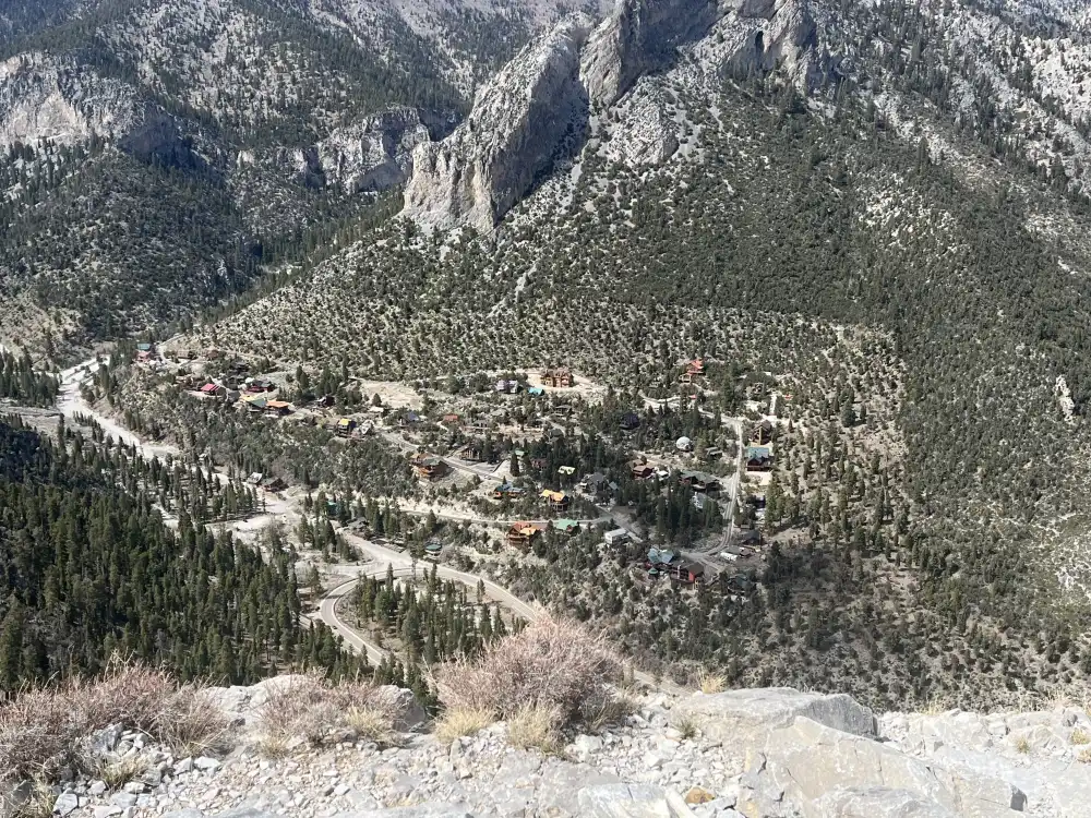
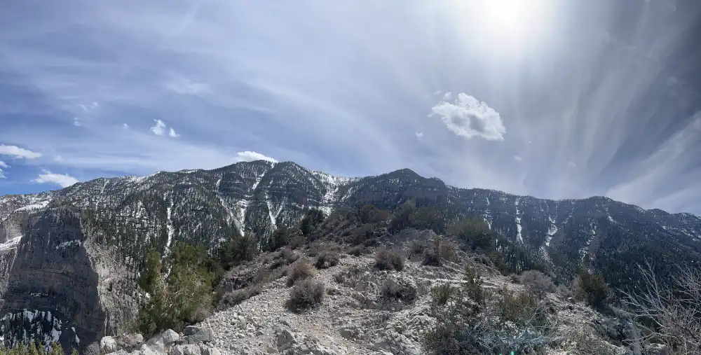
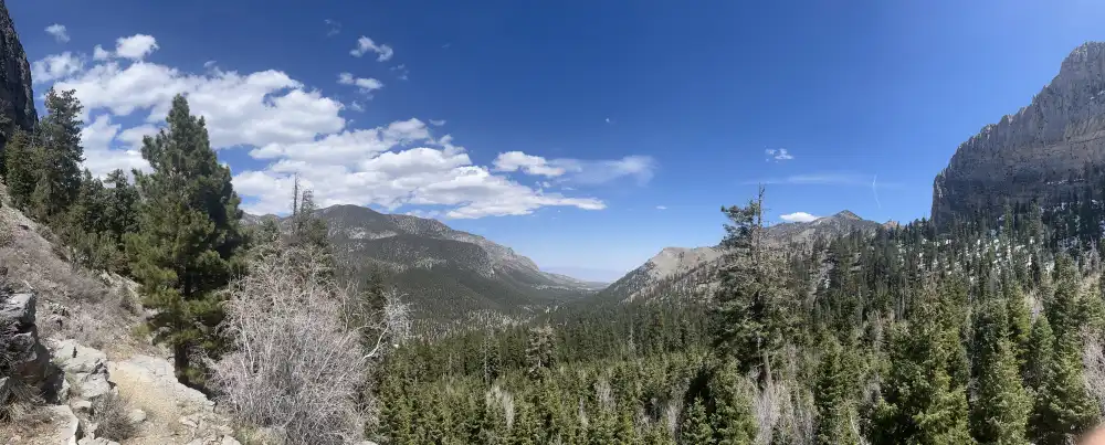
At the top of Cathedral Rock, the world opens wide in every direction — a sweeping panorama of rugged Nevada wilderness. The air is thin and crisp, carrying that high-altitude quiet broken only by the wind brushing over stone. Below, the valley stretches endlessly, winding roads and clusters of cabins dotting the slopes far beneath the cliffs. The rocky summit itself is raw and exposed, scattered with hardy desert brush and patches of loose limestone.
Looking outward, the peaks of the Spring Mountains rise in serrated layers, streaked with lingering snow and deep evergreen shadows. To the west, the desert floor glows faintly in the distance — a hazy contrast to the sharp, cool ridgelines above. It’s the kind of view that humbles you, where every switchback and steep step of the climb feels worth it. The summit isn’t just a destination; it’s a moment of stillness suspended between earth and sky.


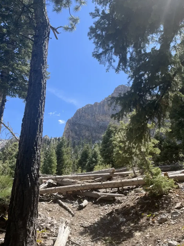
Midway Down Cathedral Rock Trail
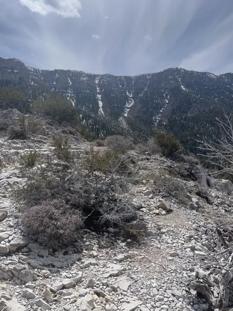
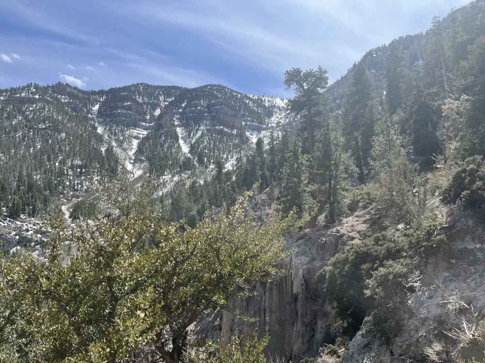
Midway down the Cathedral Rock Trail, the landscape unfolds into a sweeping mix of pine forest and exposed limestone cliffs. The descent offers a new perspective — the peaks that once loomed overhead now rise across the valley, their snow-lined ridges glowing under the afternoon sun. The air carries the scent of pine and melting snow, cool and thin at this elevation.
The narrow trail hugs the mountainside, carved into steep slopes with glimpses of distant switchbacks below. Loose gravel and patches of lingering ice crunch underfoot, while tufts of sagebrush and mountain mahogany cling to the rocky ledges. Looking out, the valley stretches endlessly into the desert floor, the transition from alpine green to dusty brown visible in soft gradients of light.
Panda moves confidently ahead, pausing at the trail’s bends as if taking in the same wide expanse. The moment feels both peaceful and wild — caught between the quiet shelter of the forest above and the vast openness waiting below.


The Trail Home
It wasn’t till the walk back that I realized that the trail was still closed. Which would explain why I didn’t see any other people at the top or on the way down. There wasn’t any snow for most of the walking path, so it must be laziness of actually checking conditions vs the danger of getting extreme weather. It’s like the pool where I live. They open it April 1st, when it is clearly hot enough in the middle of March. This was April 22nd, in Southern Nevada. It’s just like the government to try and control every aspect of our lives, including where and when we walk on public lands… Sign said up to $5k fine, six months in jail. Oops! Good thing I saw it on the way back and not the way up. No hassle, so that was a plus. Down further I saw another sign that said stay on the Trail. Doh!!! Two for two. The way up was the best part of the adventure!
Overall, the hike was amazing and the landscape serene. The views spectacular and the weather was warm enough to be in shorts and a t-shirt. I came down relaxed and in-tune with nature with water and food to spare. Panda was happy and exhausted and slept the whole way back. I hit traffic on the 215 where it bottlenecks at Jones. It was 4pm… I instantly wished I was somewhere more remote.
Cathedral Rock, Mount Charleston, Nevada
Just 45 minutes northwest of Las Vegas, Cathedral Rock is one of Mount Charleston’s most iconic and accessible hikes — perfect for first-time visitors looking to trade desert heat for alpine air. The trail offers a steady climb through pine forests, cool breezes, and sweeping views of the Spring Mountains National Recreation Area.
The Experience
The Cathedral Rock Trail is a moderately steep, well-marked path that winds about 2.8 miles round-trip, climbing nearly 1,000 feet to a rocky overlook with incredible panoramic views of Kyle Canyon below. The towering limestone cliffs that give the mountain its name rise dramatically around you, resembling a stone cathedral carved by time and weather.
Along the trail, you’ll pass through ponderosa pine, white fir, and aspen groves, which provide welcome shade in summer and vibrant color in the fall. In early spring, snowmelt feeds small streams and waterfalls that trickle down the canyon walls, adding to the tranquil, high-mountain atmosphere.
At the summit, hikers are rewarded with a natural rock ledge that makes for the perfect picnic or photo spot — a peaceful place to take in the scent of pine and the cool mountain wind after the climb.
Getting There
From Las Vegas, take US-95 North to State Route 157 (Kyle Canyon Road) and drive about 20 miles into the mountains. Look for the Cathedral Rock Trailhead just past the Mount Charleston Lodge in the town of Mount Charleston.
Parking is available at the Cathedral Rock Picnic Area, but fills up quickly on weekends. A U.S. Forest Service day-use fee is required, and restrooms are available near the lot.
Coordinates: 36°15′19.5″ N, 115°39′0.7″ W
What to Bring
- Water: The elevation (over 7,500 ft at the trailhead) can cause dehydration faster than you expect.
- Layered clothing: Temperatures can be 20–30°F cooler than Las Vegas.
- Snacks or lunch: The summit ledge is a great picnic spot.
- Good footwear: Sturdy hiking shoes with traction are a must — sections can be loose and rocky.
- Sun protection: Even with tree cover, mountain sun is strong.
Best Time to Visit
Late spring through early fall is ideal, with snow often lingering into May. The area is closed in winter due to ice and snow conditions. Visit in early morning or late afternoon for cooler temps and fewer crowds.
Quick Facts
- Lat/Lng: 36.255424, -115.650185
- Trail length: ~2.8 miles round trip
- Elevation gain: ~970 feet
- Nearest town: Mount Charleston, NV
- Trailhead elevation: ~7,700 feet
- Activities: Hiking, photography, picnicking, wildlife viewing
- Fee: Day-use fee for Cathedral Rock Picnic Area (National Recreation Area pass accepted)